Part A
![]()
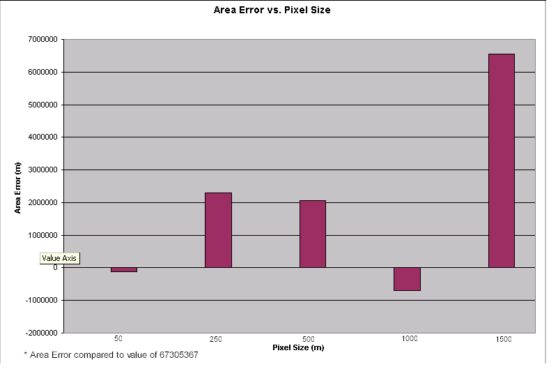
Associated graph is here
Part B

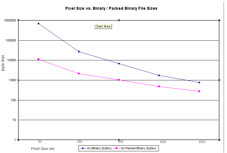
Associated graph is here
Part C
In my opinion, pixel size has quite an impact on analysis for the following reasons:
In part A, I expected that the area error would increase as pixel sizes increased. However this was not the case (the supporting tables / graphs illustrate this). For 50m pixels the error is very low, and logically for 1500m pixels the error is very high. But the error is similar for 250 and 500m pixel sizes and relatively much lower for 1000m pixels. This may be attributed to the relative location of the pixels of SYMBOL = 217 and where they reside when computing the area; where they may overlap into other pixel spaces (maybe due to the generalization of larger pixels). The generalization between differing pixel sizes may have little importance in some cases (e.g. from 250 - 500m).
In part B, the impact is seen directly in the byte size of the files. File sizes are logically larger as pixel sizes decrease, because of the higher definition needed for smaller pixels. The packing ratio is also better as pixel size decreases; I believe this is attributed to more of the same values as the pixel size decreases (50, 100m) as opposed to less of the same values in the larger pixel sizes (1000, 1500m). Therefore, the actual type of analysis of the data must be determined from the start of the project / task. For example, if one is using data to analyze characteristics of highly accurate ground control points (>3 metres), the pixel sizes should be reflective of this (this equates to larger file sizes). However, if one is using global data to assess general characteristics of a world map, pixel sizes may be higher, which results in smaller sized files.
Keep in mind that along with the above impacts of pixel sizes for data, another issue which can be vital is disk space and cost of analysis. If one was to use geo-spatial data as a web service to clients, disk space, intended audience, network traffic and technology are very important issues to consider. One option would be to offer 'browse images' for general viewing, then pointing the user to the raw files for use (e.g. via ftp, sometimes behind a geocommerce interface). A good example that I am involved in is CEONet .